
Environmental Management
Longreach Airport seeks to operate and develop the airport in an environmentally responsible and sustainable manner.
This approach is underpinned by the Environment Policy which guides activities at Longreach Airport.
Click here to read the Longreach Airport Environment Policy.

Environmental Context
Longreach Airport is located approximately 1.5 km from Longreach town centre, comprises approximately 260 hectares of land, bounded by rural land to the north and east, and residential and recreational open space to the south and west.
The airport is located within the Central Downs subregion of the Mitchell Grass Downs bioregion. The Mitchell Grass Downs bioregion consists of largely treeless plains with some occasional ridges, rivers and gorges (ACRIS Management Committee, 20081). The bioregion is characterised by undulating downs on shales and limestones with Mitchell grass (Astrebla spp.) grasslands and Acacia low woodlands. The soils are predominantly deep heavy grey and brown cracking clays often with self-mulching and sometimes stony surfaces (Mitchell Grass Downs Flora Expert Panel Report 2009. Department of Environment and Resource Management).
Mapping from the Atlas of Australian Soils indicates that the geology in the vicinity of the airport is classified as gently undulating clay plains, with soil described as brown and red self-mulching cracking clays.
The airport is located approximately 190 m above sea level and is within the Cooper Creek Catchment within the Lake Eyre basin.
Drainage from the airport feeds into Watyakan Creek, approximately 1.5 km downstream of the airport.
Bastin G and the ACRIS Management Committee, Rangelands 2008 — Taking the Pulse, published on behalf of the ACRIS Management Committee by the National Land & Water Resources Audit, Canberra.
Climate
 Longreach Airport participates in the Airports Council International (ACI) Airport Carbon Accreditation (ACA) program and is accredited to Level 4 until 30 June 2028. This means that we are committed to reducing our Scope 1 and Scope 2 emissions in line with our target emissions trajectory and to working with our stakeholders to drive reductions in Scope 3 emissions. We measure our Scope 1, 2 and 3 carbon footprint each year.
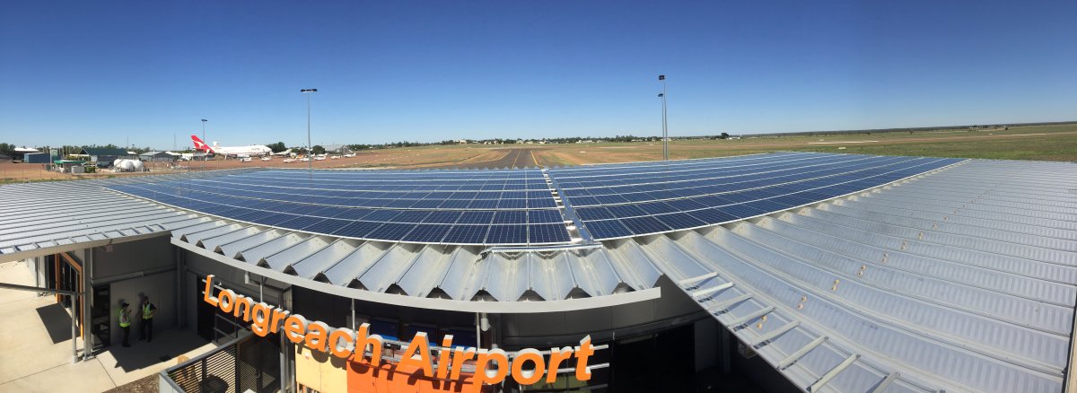
Our onsite solar, situated on the terminal roof, generates around 60%* of our electricity needs annually. We also voluntarily surrender renewable energy LGCs for part of our grid electricity consumption.
Our parent company, Queensland Airports Limited is exploring how it can support the decarbonisation of aviation through the use of sustainable aviation fuel (SAF), and electric, electric hybrid and hydrogen aircraft.
Click here for more information on QAL’s approach and commitments to ESG.
*based on our FY25 electricity consumption and activities